Gloucester
Gloucester is a city in Massachusetts. It is part of Boston’s North Shore. An important center of the fishing industry and a popular summer destination, Gloucester consists of an urban core on the north side of the harbor and the outlying neighborhoods of Annisquam, Bay View, Lanesville, Folly Cove, Magnolia, Riverdale, East Gloucester and West Gloucester. It is bounded by Rockport to the east, Ipswich Bay to the north, Essex and Manchester-by-the-Sea to the west and Massachusetts Bay to the south.
Save lots of time and costly mistakes, use our vacation planner and get help from our Virtuoso Travel advisor that is a Massachusetts expert. We do it all for you, air, car, hotels, and everything else you desire.
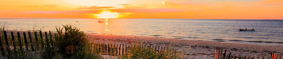
America’s oldest fishing port. Since 1623, Gloucester has been serving the world as a harvester of quality seafood. First named “Le Beauport” by Samuel de Champlain because of its beautiful harbor and scenic rocky shores, Gloucester has been a destination community ever since. Those seeking spectacular natural beauty, an energetic and picturesque working port, a diverse population who continue to honor their cultural traditions, a variety of recreational activities, and one of the premier art colonies of our country, enjoy visiting this historic city. Conveniently located less than one hour from Boston, Gloucester is a place of welcome for a visit, to live, or to build a successful business.
Gloucester History
The boundaries of Gloucester originally included the town of Rockport, in an area dubbed “Sandy Bay.” That village separated formally on February 27, 1840. In 1873, Gloucester was reincorporated as a city.
Early Gloucester
Gloucester was founded at Cape Ann by an expedition called the “Dorchester Company” of men from Dorchester (in the county of Dorset, England) chartered by James I in 1623. This date allows Gloucester to boast the first settlement in what would become the Massachusetts Bay Colony, as this town’s first settlement predates both Salem, Massachusetts in 1626, and Boston in 1630. This first company of pioneers made landing at Half Moon Beach, and settled nearby, setting up fishing stages in a field in what is now Stage Fort Park. This settlement’s existence is proclaimed today by a memorial tablet, affixed to a 50′ boulder in that park.
Life in this first settlement was harsh and it was short-lived. Around 1626 the place was abandoned, and the people removed themselves to Naumkeag (what is now called Salem, Massachusetts), where more fertile soil for planting was to be found. The meetinghouse was even disassembled and relocated to the new place of settlement. At some point in the following years – though no record exists – the area was slowly resettled. The town was formally incorporated in 1642. It is at this time that the name “Gloucester” first appears on tax rolls, although in various spellings. The town took its name from the great Cathedral City in South-West England, where it is assumed many of its new occupants originated.
This new permanent settlement focused on the Town Green area, an inlet in the marshes at a bend in the Annisquam River. This area is now the site of Grant Circle, a large traffic-rotary at which MA Route 128 mingles with a major city street (Washington Street/ Rt 127). Here the first permanent settlers built a meeting house and therefore focused the nexus of their settlement on the ‘Island’ for nearly 100 years. Unlike other ancient coastal towns in New England, development in Gloucester was not focused around the harbor as it is today, rather it was inland that people settled first. This is evidenced by the placement of the Town Green nearly two miles from the harbor-front.
The Town Green is also where the settlers built the first school. By Massachusetts Bay Colony Law, any town boasting 100 families or more had to provide a public schoolhouse. This requirement was met in 1698, with Thomas Riggs standing as the town’s first School-Master.
Early industry included subsistence farming and logging. Because of the poor soil and rocky hills, Cape Ann was not well suited for farming on a large scale. Small family farms and livestock provided the bulk of the sustinence to the population. Fishing, for which the town is known today, was limited to close-to-shore, with families subsisting on small catches as opposed to the great bounties yielded in later years. The fisherman of Gloucester did not yet command the Grand Banks until the mid-18th century.
Early Gloucestermen cleared great swaths of the forest of Cape Ann for farm and pasture land, using the timber to build structures as far away as Boston. The rocky moors of Gloucester remained clear for two centuries until the forest reclaimed the land in the 20th Century. The inland part of the island became known as the ‘Commons’ the ‘Common Village’ or “Dogtown”. Here small dwellings lay scattered amongst the boulders and swamps, along roads that meandered through the hills. These dwellings were at times little more than shanties, only one was even two-stories tall. Despite their size, several generations of families were raised in such houses. One feature of the construction of these houses was that under one side of the floor was dug a cellar hole (for the keeping of food), supported by a foundation of laid-stone (without mortar). These cellar holes are still visible today along the trails throughout the inland part of Gloucester; they, and some walls, are all that remain of the village there.
Gloucester Growth
Harbor View & Ten Pound Island Light in c. 1915The town grew, and eventually colonists lived on the opposite side of the Annisquam River. This, in a time of legally mandated church attendance, was a long way to walk – or row – on a Sunday morning. In 1718 the settlers on the opposite shore of the river split off from the First Parish community at the Green and formed ‘Second Parish.’ While still part of the Town of Gloucester, the people of Second, or ‘West’, Parish now constructed their own Meetinghouse and designated their own place of burial, both of which were in the hills near the marshes behind Wingaersheek Beach. The Meeting house is gone now, but deep in the woods on the Second Parish Road trail one can still find the scattered stones of the abandoned Burial Ground.
Other parts of town later followed suit. Third Parish, in Northern Gloucester, was founded in 1728. Fourth Parish split off from First Parish in 1742. Finally, in 1754, the people of Sandy Bay (what would later be called Rockport) split off from First Parish to found Fifth Parish. The Sandy Bay church founding was the last religious re-ordering of the Colonial Period. All of these congregations still exist in some form with the exception of Fourth Parish, the site of whose meeting house is now a highway.
At one time, there was a thriving granite industry in Gloucester.
