Iceland
Iceland is an island of contrasts, where heaven and earth meet, and where the sagas of the vikings were written under glaciers, erupting volcanoes and the magnificent midnight sun…and still, today, it´s all there preserved unspoiled by the Icelanders.
Iceland is the place for people who want to see and do new things. Discover a world that nature is still creating and the people and culture that live and thrive in a challenging, beautiful and purely natural environment.
How about some inspiration? We’ve been customizing Iceland vacation itineraries for discriminating travelers for more than 20 years. It helps us help you, if you begin with our vacation planner we will make sure you will enjoy Iceland; get you the best airfare, plus privileged access with luxury amenities and special touches. We’ll save you time and prevent costly mistakes.
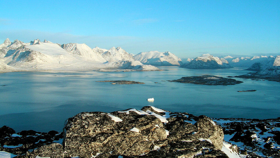
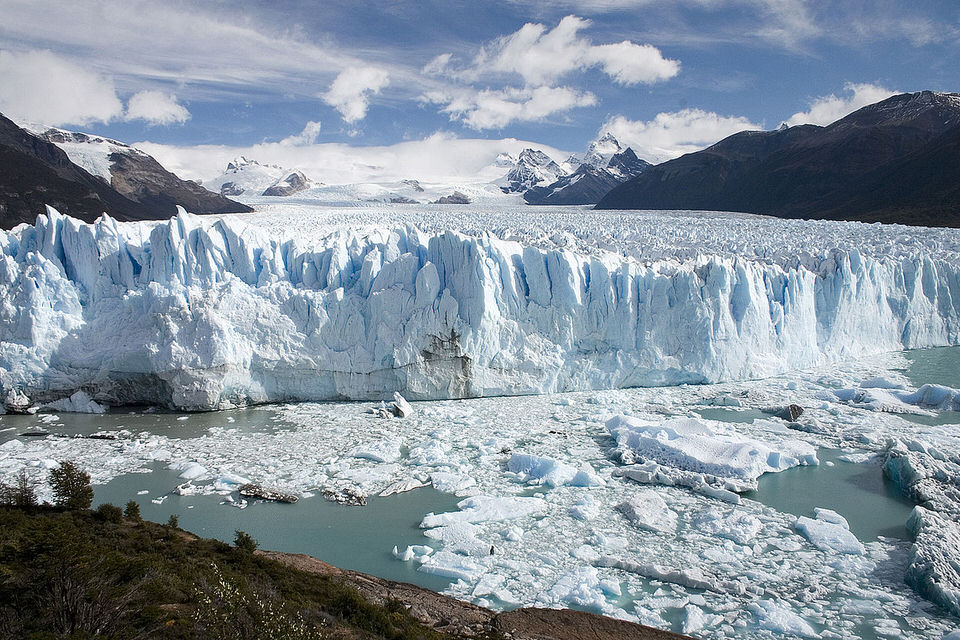
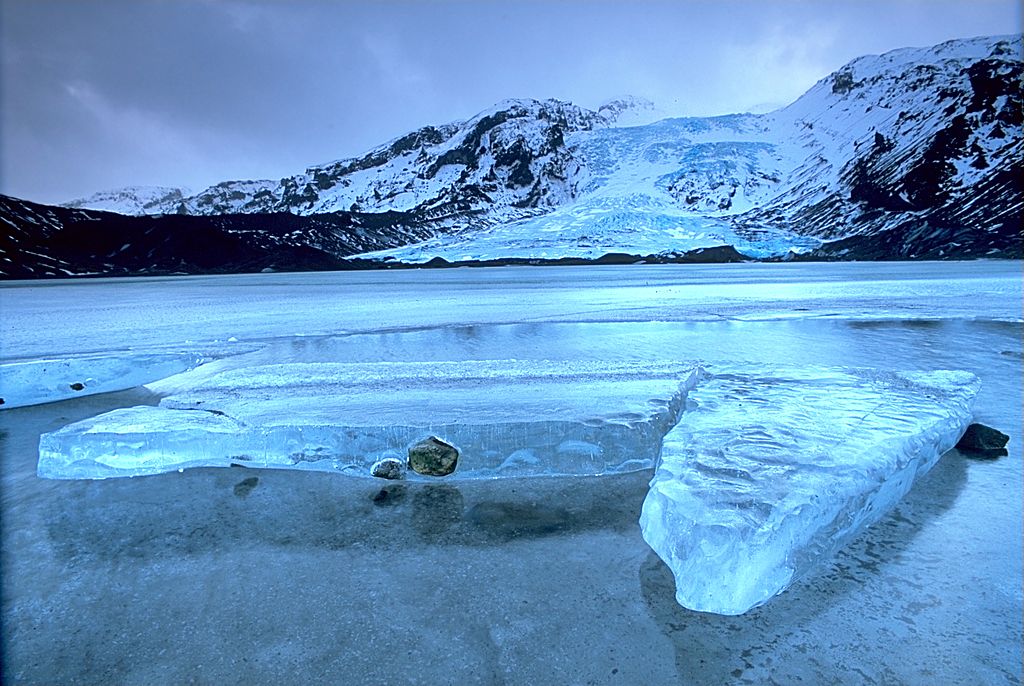
There’s energy everywhere in Iceland. See how it shapes the mountains and fjords and vast uninhabited spaces, blazes from the midnightsun in summer and the northern lights in winter, surges in waterfalls and creeps in glaciers, erupts in volcanoes and bubbles in natural hotsprings. And energy bursts forth in the action and activities that make Iceland one of the most exciting places on the map today. Take on the challenge of doing battle with the mighty forces of nature. Or live life in the city and towns where you feel instantly at home and where the night is always young, whatever the time of day or year.
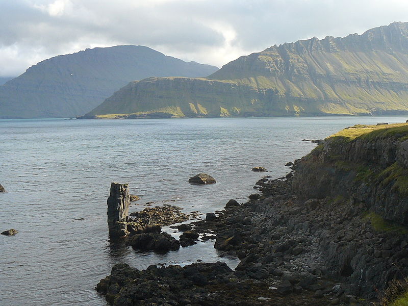
Geologically speaking, Iceland is the youngest country in the world, and still growing. A mere 20 million years ago, the island was born from the North Atlantic seabed in a huge volcanic eruption like the ones that are still going on today. Its lava features have been chiselled in places and smoothed elsewhere by Ice Age glaciers and pounding waves, to leave masterpieces of nature’s artistry that astound the urban imagination.
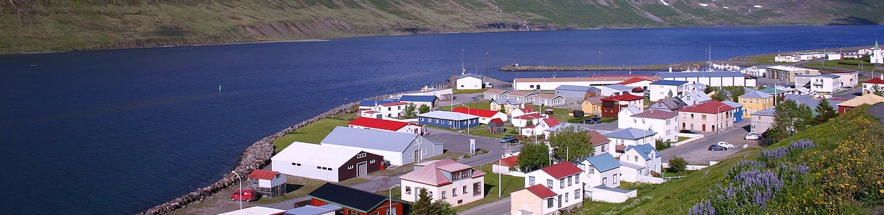
It was to this strange world that the first settlers came only 1,100 years ago, making Iceland the last country in Europe to be inhabited by man: vikings in quest of freedom and new and richer lives. Their spirit lives on in the independent-minded people for whom modern Iceland is home today, people who live in harmony with the elements and a land that is always changing before their very eyes.
Travellers visit Iceland today for exactly the same reasons that motivated the Vikings who discovered the place in the ninth century -the love of freedom. Whether your delight is in vast, untouched and uninhabited expanses of landscape, or strolling around town making friends, you’ll feel free in Iceland. And a whole host of travel options are available if instead of taking organized tours you want to decide the pace for yourself.
Carrental has become a big favorite in recent years. Many drivers opt to take the Ring Road (1,340 km) right around the country, with as many detours as they wish. There’s local accommodation to suit every taste and budget, ranging from quality hotels in larger towns, through summer hotels with beds or room for sleeping bags, to guesthouses, farm accommodation and campsites with standard facilities.
A wide range of vehicles can be rented, including 4WD, but drivers are advised not to venture alone where there are unabridged rivers on the tracks. A summer car ferry operates between Seysur in the east and ports in northern Europe, for travelers who prefer the feel of their own familiar wheels.
Those who fancy the challenge of touring under their own physical steam will find that cycling more than repays the calories spent. Cyclists should come prepared for all weather, even at the height of summer. A number of cycle rentals operate in Reykjavik and elsewhere, offering good mountain bikes, while both the car ferry and aircraft take cycles aboard too.
Go-it-alone travelers should always remember that it’s sometimes a very short step between feeling free and getting lost. Hikers, glacier explorers and interior wanderers should always notify someone of their plans when heading out into the wilds on longer hauls. Also, off-road driving is strictly forbidden – sensitive sub-Arctic vegetation needs the freedom to grow and flourish too, and surface damage from tires can take decades to heal.
